Urban Climate Risk Intelligence
Strategic Question
Which urban areas face the highest compound climate risk - and who is most exposed? Cities face an accelerating combination of heat wave intensity, urban drought, and environmental stress.. This project built a granular urban climate risk framework for a government entity using city-block-level mulitlayered geospatial data, replacing aggregate climate statistics with a spatially precise, multi-dimensional exposure model.
Approach
We developed an integrated spatial risk framework combining environmental monitoring, socioeconomic vulnerability mapping, and mobility accessibility analysis to produce a block-level climate risk index.
The framework combines:
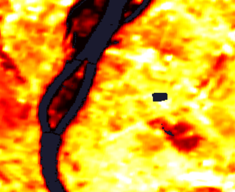
High-resolution land surface temperature and urban heat island intensity derived from satellite imagery,
Long-term climatic trend analysis capturing shifting heat wave frequency, duration, and intensity at sub-district resolution
Vegetation cover and impervious surface mapping to identify cooling infrastructure gaps and drought exposure proxies
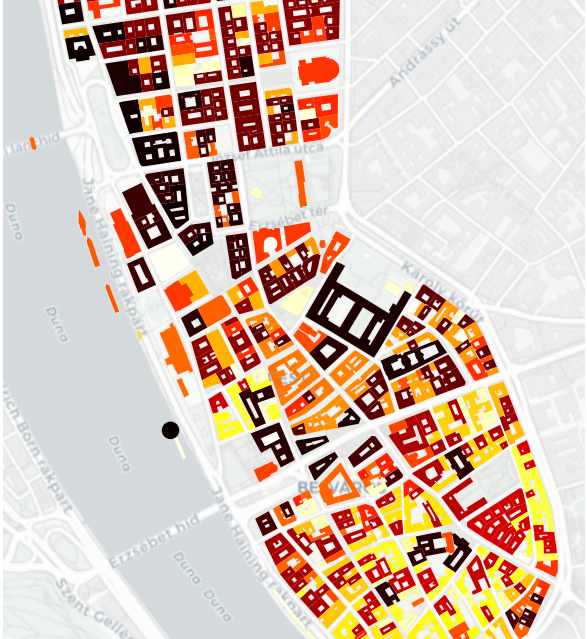
Block-level socioeconomic data
Mobility and accessibility modelling
Etc
The result is a composite risk surface that captures not just where heat is most intense, but where it intersects with the populations and infrastructure least equipped to absorb it.
Outputs
For each urban block and neighbourhood tier:
Compound climate risk score combining physical exposure and socioeconomic vulnerability
Drought exposure proxy surface derived from vegetation and surface permeability data
Priority intervention zones ranked by risk severity and population exposure
Strategic Applications
Urban resilience planning and climate adaptation investment prioritisation
Infrastructure siting for cooling centres, green corridors, and emergency response facilities
Real estate portfolio risk assessment incorporating compound climate exposure at asset level
Public health preparedness — identifying heat vulnerability hotspots before extreme weather events
Urban development impact assessment for new districts and densification proposals
Policy targeting — directing social protection and cooling resources to highest-risk communities
The result is a spatially precise, evidence-based climate risk intelligence layer — supporting urban planning and investment decisions that aggregate climate statistics and conventional risk models cannot produce alone.