Global Construction Activity Intelligence
Strategic Question
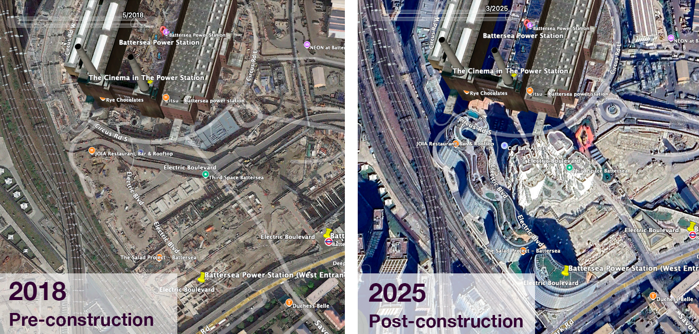
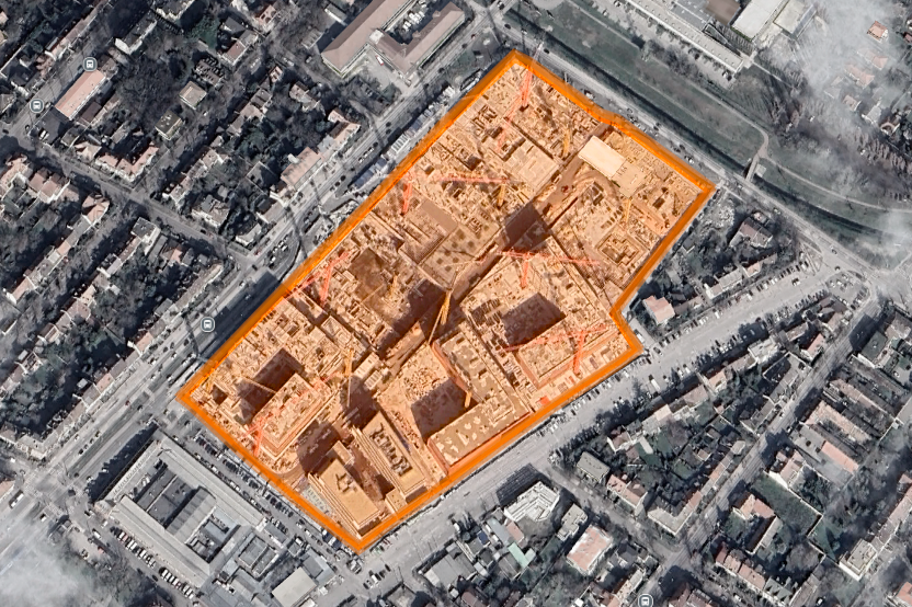
Where is large-scale construction physically occurring — and how early can it be detected? Administrative records are delayed and inconsistent. This project builds a satellite-native monitoring framework that measures construction activity directly from high-resolution, multi-year remote sensing time series.
Approach
We developed a GeoAI-driven detection system that analyzes historical satellite imagery and radar signals to identify sustained surface disturbance consistent with major construction.
The framework combines:
Multi-year temporal change detection
Radar-based surface disruption signals
Optical indicators of vegetation loss and built-up growth
Persistence filters to remove seasonal or transient noise
The system is deliberately conservative: when construction is flagged, it is highly likely to be real.
A pilot validation across multiple cities confirmed that sustained construction leaves a consistent, physically interpretable satellite signature.
Outputs
For each block or parcel:
Probability of construction activity
Estimated timing (6-month resolution)
Activity status (active / completed / uncertain)
These signals can be aggregated into neighborhood-, city-, or metro-level construction intensity indices.
Strategic Applications
Early identification of supply pipeline shifts
Forward-looking real estate indicators
Monitoring of redevelopment corridors
Cross-city construction benchmarking
Capital allocation and exposure analysis
Integration with land-use and building stock models
The result is a scalable, GeoAI-enabled construction intelligence layer derived from physical observation — not administrative reporting.