Global Building Stock Intelligence
Strategic Question
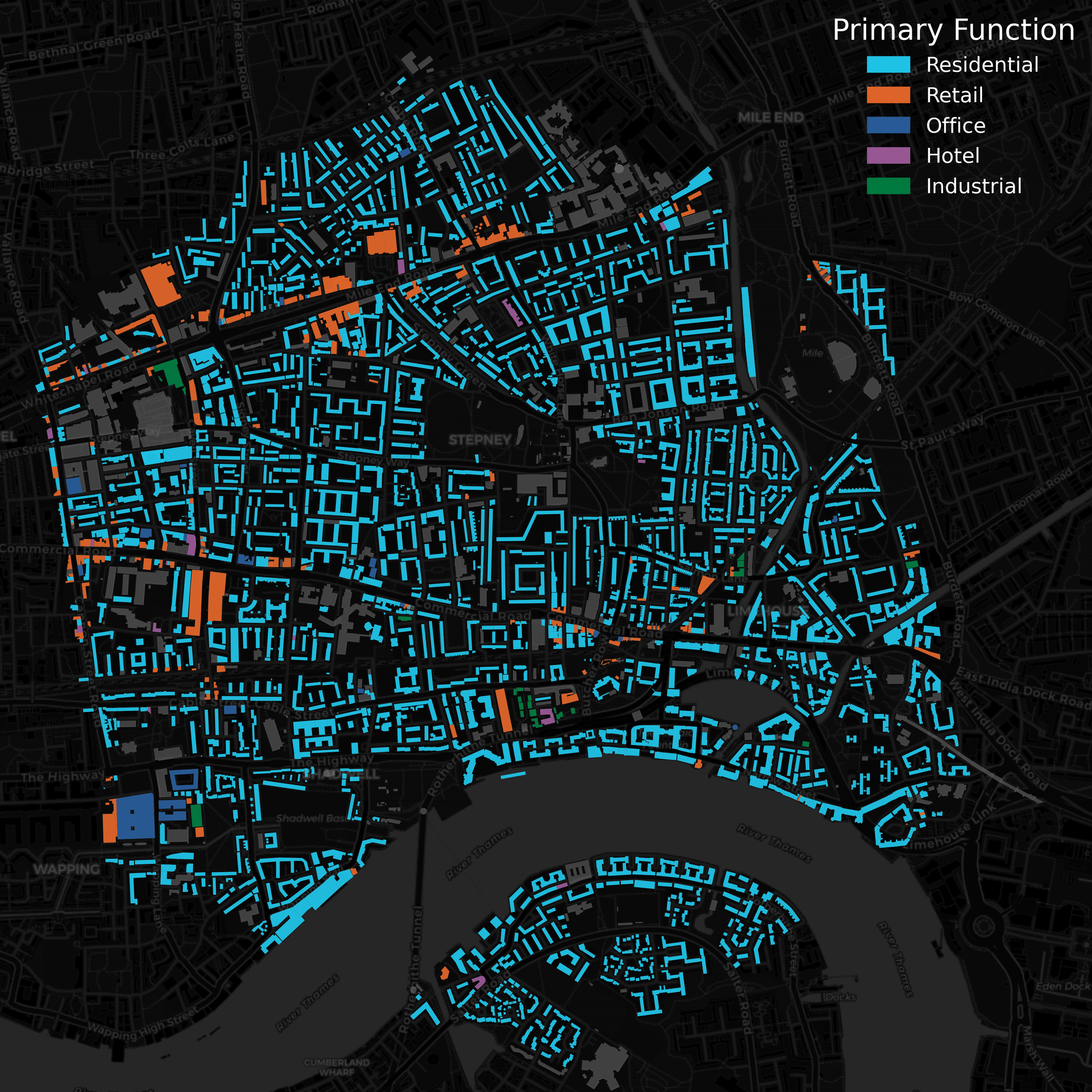
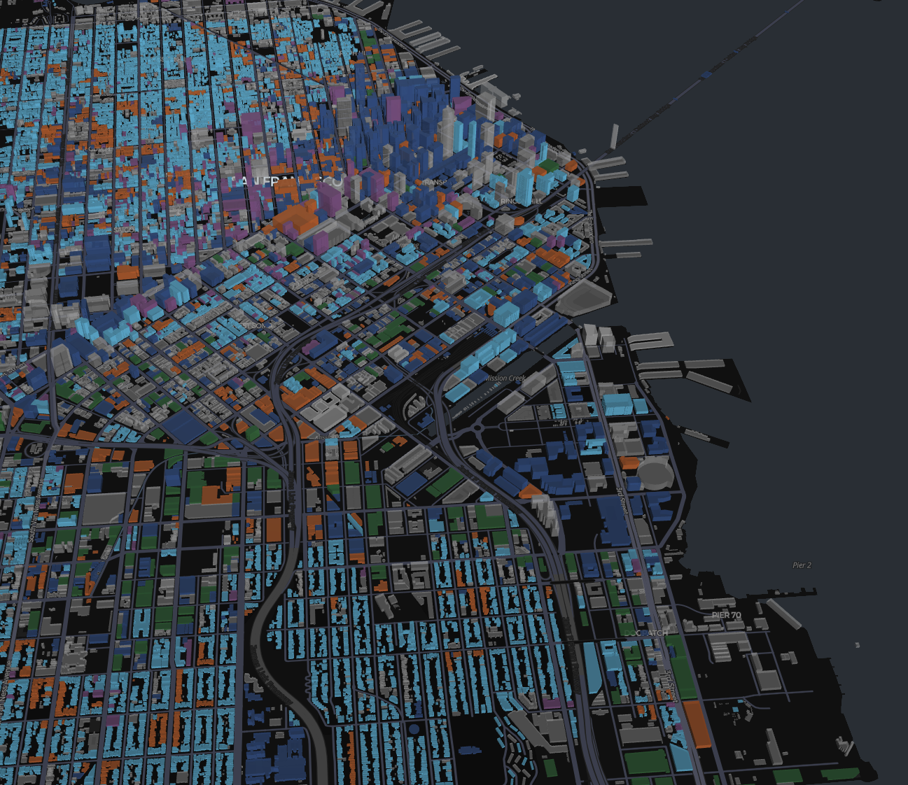
How much built space actually exists — by type, by location, and how is it changing? Institutional investors, economic researchers, and urban strategists routinely make capital allocation decisions without reliable data on what is physically built where. Conventional real estate databases are incomplete, inconsistent across geographies, and rarely extend below district level. This project built a fine-grained global building stock estimation framework covering 100 cities worldwide, replacing fragmented property databases with a unified, footprint-level spatial intelligence layer.
Approach
We developed an integrated geospatial data science framework combining large-scale map data, machine learning, and temporal modeling to produce building stock estimates at individual footprint resolution across global city portfolios.
The framework combines:
Footprint-level building geometry, POI, and other structural urban data
Large-scale remote sensing, demographics, and other spatial data sources
Local data sources, including land use, building properties, and even LiDAR data
A hybrid machine learning approach to capture footprint-level functional category and usage share
An ML pipeline estimating overall footprint-level building stock and function-level usage share
Temporal modeling module producing historical backcast estimates from 2000 to 2025 and forward projections to 2030, creating a continuous spatiotemporal representation of building stock evolution
Strategic Applications
Institutional real estate portfolio construction and market sizing across global city portfolios
Infrastructure investment targeting based on built environment density and functional composition
Urban economic research requiring consistent cross-city building stock comparisons
Retail network planning and location intelligence grounded in physical built environment data
Construction activity monitoring and urban growth forecasting for capital allocation decisions
Regulatory and planning applications requiring evidence-based estimates of floor space supply by category
The result is a spatially precise, temporally consistent building stock intelligence layer — supporting investment and research decisions that conventional property databases and planning records cannot produce at global scale.

The Echo Project
A bold reimagining of a timeless brand.