Retail Competitive Site Optimization
Strategic Question
Where should a fast-food chain open its next location in a contested urban market? While most site selection processes rely on trade area heuristics or broker relationships, this study addresses a more structural question: Which zones offer the highest population exposure, transit accessibility, and competitive white space — simultaneously?
Framework
We developed a city-scale, constraint-first geospatial model covering the Budapest metropolitan area. The framework integrates:
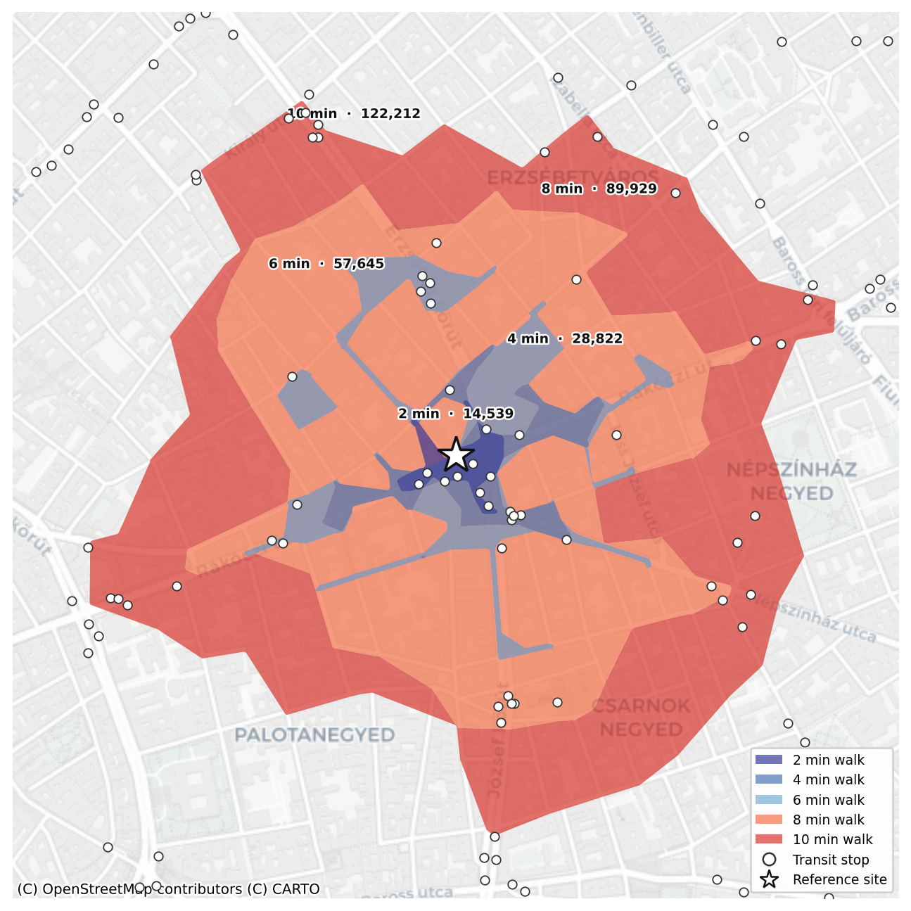
Street network isochrones at 2, 4, 6, 8, and 10-minute walking thresholds
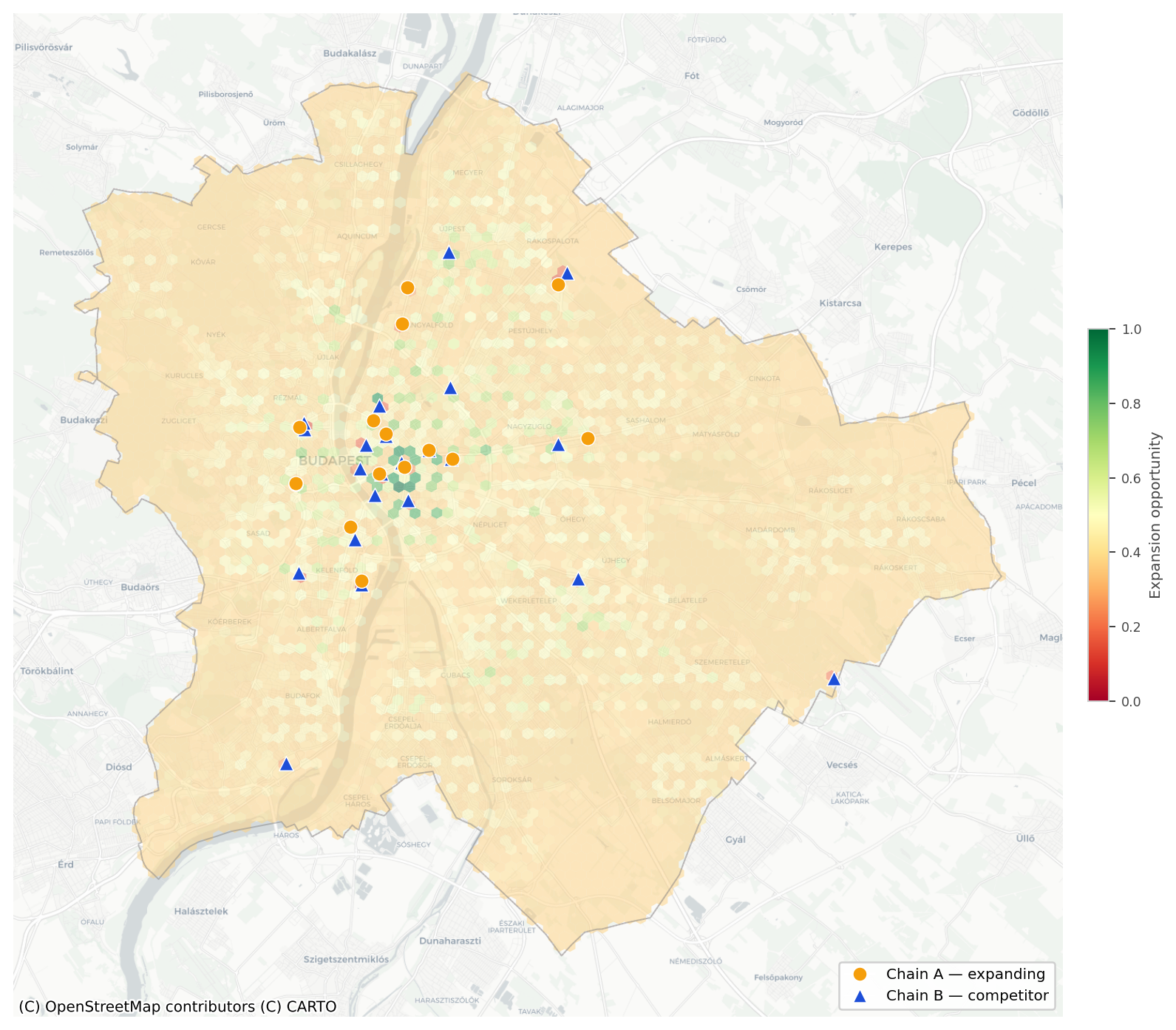
Residential population density from the Global Human Settlement Layer (2025)
Public transit accessibility weighted by service type — subway, tram, trolleybus, and bus
Competitor footprint density mapped at hexagonal grid resolution
Own-brand coverage gaps to avoid cannibalisation
All variables were aggregated into a uniform H3 hexagonal grid at resolution 9 (~170m diameter) to ensure consistent spatial comparability across the city. Rather than modelling demand in isolation, the framework scores each zone against revealed competitive behaviour and present-day infrastructure conditions. A composite opportunity score was constructed weighting population reach (35%), transit access (25%), competitor absence (25%), and own-brand gap (15%).
Findings
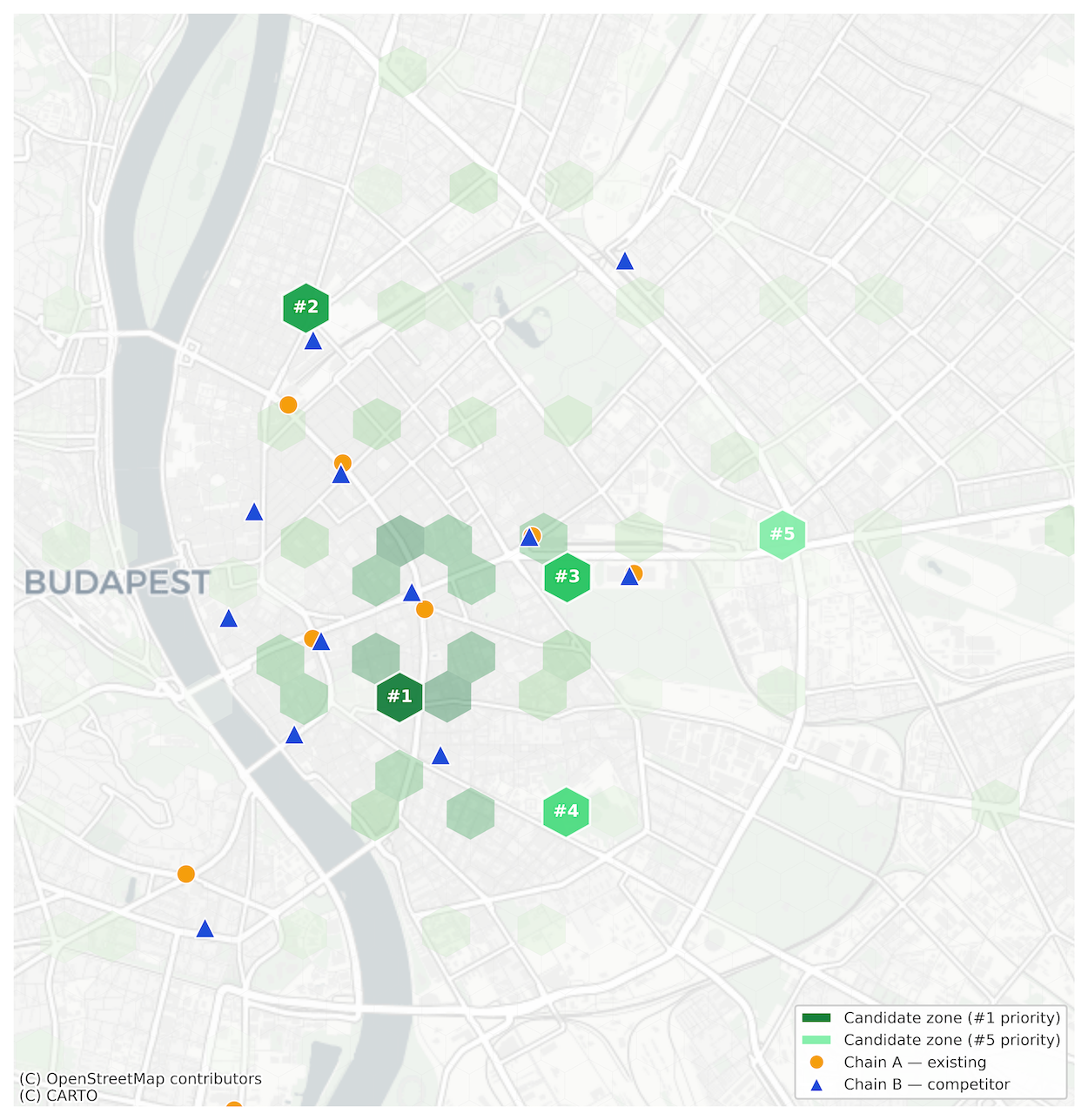
Current fast-food presence is heavily concentrated in the inner districts — V, VI, VII, and VIII — leaving several transit-rich residential corridors systematically underserved. Network isochrone analysis reveals that pedestrian catchment varies significantly by location: a 10-minute walk from a central site can reach 40,000–80,000 residents depending on street connectivity, river barriers, and block structure. Circular buffer assumptions overestimate catchment by 30–60% in constrained urban geometries. Five priority expansion zones were identified where high residential density, strong transit access, and low competitive pressure converge. These zones are spatially distributed across the city, ensuring portfolio diversification rather than cluster saturation.
Strategic Implications
This work reframes retail site selection as a constraint-governed infrastructure problem, not a purely demand-driven or relationship-driven process. Applications include:
New site prioritisation before lease negotiation or broker engagement
Portfolio gap analysis against a competitor's revealed network strategy
Cannibalisation risk assessment for proposed locations
Transit-anchored catchment modelling for delivery radius planning
City-entry feasibility screening for new market expansion
Franchisee territory design and protected zone definition
The output is not a demand forecast. It is a bounded urban feasibility surface — supporting network strategy at city scale with the resolution to act at street level.